Wedi’i ychwanegu at eich Cynllunydd Taith isod
Cyfrifiannell pellter
Hidlwyr Map
Customise your trip with our filters.
Hidlwyr Map

Ewch o un opsiwn i’r llall isod i ddangos y marcwyr sydd ar gael.
Cyffredinol Marchogaeth BeicioLlety
Pwyntiau o ddiddordeb
Gwasanaethau
Llwybrau
Llety
Pwyntiau o ddiddordeb
Trafnidiaeth
Llety
Pwyntiau o ddiddordeb
Trafnidiaeth


Mae'r proffil o uchder eich teithlen yn cael ei greu pan fyddwch yn defnyddio’r cyfrifiannell pellter (uchod) i dynnu llinell.
Mae'r proffil o uchder eich teithlen yn cael ei greu pan fyddwch yn defnyddio’r cyfrifiannell pellter i dynnu llinell.

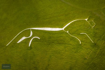
The internationally-renowned Bronze-Age Uffington White Horse can be seen for miles away leaping across the head of a dramatic dry valley in the Ridgeway escarpment. The Horse is only part of the unique complex of ancient remains that are found at White Horse Hill and beyond, spreading out across the high chalk downland.
The Manger, a dramatic dry valley has steep rippled sides left from the retreating permafrost during the last Ice Age. To the east of the Manger lies Dragon Hill, a small roundish hill with a flattened top, said to be the site where St. George, England's patron saint, slew the dragon.
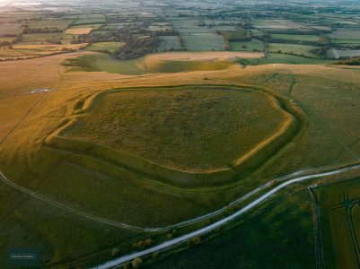
On White Horse Hill is an Iron Age hillfort known as Uffington Castle. A simple design of one rampart and ditch, the castle at 860 feet (262m) above sea level forms the highest point in Oxfordshire, with views for miles around over six counties.
Burial Mounds can also be seen around this site, dating from the Neolithic period and reused up to the Saxon age.
Discover more through the Ridgeway Top 50 Story of Chalk, St George, Chalk Figures, Highest Hills, Hillforts, Trigs and more!

