
Added to your Itinerary Planner below
Distance calculator
Map Filters
Customise your trip with our filters.
Map Filters

Toggle between the options below to show available markers.
General info Equestrian Info Cycling InfoAccommodation
Points of interest
Services
Routes
Accommodation
Points of interest
Transport
Accommodation
Points of interest
Transport


The custom route elevation is created when you use the distance calculator (above) to draw a line.
The custom route elevation is created when you use the distance calculator to draw a line.

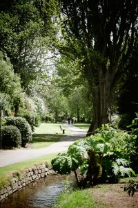
The Parks is a series of gardens and landscaped arboretum that were once part of a thirteenth century park.
Created in the 1920s it includes three sections: The Parks Walk, Woodcombe Walk and Bratton Walk. They follow the Bratton Stream, which once ran through meadows, and now winds its way through the gardens until it disappears under Park Street, eventually emerging onto the beach.