Added to your Itinerary Planner below
Distance calculator
Map Filters
Customise your trip with our filters.
Map Filters

Toggle between the options below to show available markers.
General info Equestrian Info Cycling InfoAccommodation
Points of interest
Services
Routes
Accommodation
Points of interest
Transport
Accommodation
Points of interest
Transport


The custom route elevation is created when you use the distance calculator (above) to draw a line.
The custom route elevation is created when you use the distance calculator to draw a line.

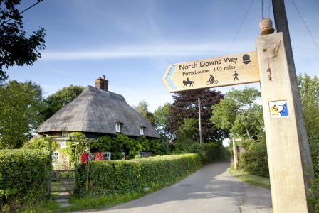
Head out on the Via Francigena from Canterbury to Shepherdswell on this 17km linear walk.
Walk in the footsteps of pilgrims, as you pass the ruins of St Augustine’s Abbey and slip into fields with the spires of the cathedral behind you.
Pass through the pretty villages of Patrixbourne and Womenswold with their ancient churches and tea rooms for refreshment, before heading into the village of Shepherdswell where you can pause for a scenic ride on the East Kent Railway.
Allow 4 hours.